Lake Nona has no Turnpike exit, and most residents never use the Turnpike to get to work. Here is how to reach it, where it actually takes you, and what to know before a long run north or south.
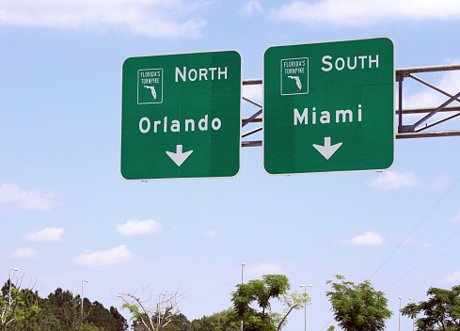
Florida's Turnpike is a toll road of about 309 miles: a 265-mile mainline from I-95 in Miami Gardens to I-75 near Wildwood, plus the 48-mile Homestead Extension to Florida City. Lake Nona has no Turnpike exit of its own. Residents reach it by taking SR 417 west to Exit 251, a full systems interchange completed in 2016, or the Beachline (SR 528) west to Exit 254. The Turnpike is a regional road for Lake Nona households, used for trips to South Florida and to I-75, not for daily commutes. North of Osceola Parkway it is eight lanes; south of it, Florida's Turnpike Enterprise is widening it from four lanes to eight in stages.
Listings love the phrase "easy Turnpike access." In Lake Nona it's true, with an asterisk: you can't get on the Turnpike from Lake Nona. You get on SR 417 first, and the Turnpike is where 417 takes you.
That distinction matters more than it sounds. Buyers relocating here sometimes picture the Turnpike as their commute road, the way I-4 is for half of Orlando. It isn't. For a Lake Nona household the Turnpike is the road you take to the Keys, to a game in Miami, or north toward I-75 for the holidays. Here's how it actually fits into life down here.
Does Lake Nona have its own Florida Turnpike exit?
No. The closest Turnpike access for Lake Nona is Exit 251, the SR 417 interchange, which you reach by taking 417 west.
The Turnpike runs northwest to southeast through the west side of the Orlando metro, well west of Lake Nona. The Central Florida GreeneWay (SR 417) is the connector: it loops from the Lake Nona and airport area west toward Celebration and crosses the Turnpike on the way. At that crossing is Exit 251, a systems interchange with ramps in every direction.
That interchange is newer than many residents realize. The first ramps between the Turnpike and 417 opened in January 2015, and the rest were finished in May 2016, including the connections from the southbound Turnpike onto 417. Before that, a trip south from Lake Nona meant working through Osceola Parkway or the Beachline to find a way on.
The second option is Exit 254 in Sky Lake, a large combined interchange with the Beachline Expressway (SR 528) and Orange Blossom Trail. If you live at the north end of Lake Nona near 528, taking the Beachline west to Exit 254 is a reasonable alternative. For most of Lake Nona, 417 to Exit 251 is the default.
Is the Turnpike a good commute road from Lake Nona?
For most Lake Nona commutes, no: the jobs are on SR 417, SR 528 and Narcoossee Road, and the Turnpike is off to the west.
Lake Nona's big employers are Medical City and Orlando International Airport, both on the east side of the metro, along with downtown Orlando to the north. None of them is a Turnpike trip. The GreeneWay and the Beachline carry those commutes, and we cover them in our guide to SR 417 and SR 528 and in our Lake Nona commuting guide.
The exception is a job that sits near a Turnpike exit on the west or southwest side of the metro. There, the Turnpike can make up part of the route. Before you count on it, run the trip in a mapping app at your actual commute hour. That tells you more than any listing will, including this blog.
Where does the Turnpike take Lake Nona residents?
South to Fort Pierce, West Palm Beach, Fort Lauderdale and Miami, and north to I-75 near Wildwood, the road out of the state.
The mainline opened in stages between 1957 and 1964 and runs from I-95 in Miami Gardens to I-75 near Wildwood. Southbound it parallels I-95 through Palm Beach, Broward and Miami-Dade counties. Northbound it crosses I-4 and ends at I-75, which is the usual route for Lake Nona drivers headed to Ocala, Gainesville, or out of Florida entirely.
One thing it doesn't do is go to Tampa. That's an I-4 trip.
Turnpike exit numbers are mileposts, so distances along the road are simple subtraction. Starting from Exit 251, here is how far the service plazas are, and where the road ends to the north:
| Stop | Milepost | Turnpike miles from Exit 251 |
|---|---|---|
| Northern end at I-75, Wildwood | 309 | About 58 north |
| Okahumpka Service Plaza | 299 | About 48 north |
| Turkey Lake Service Plaza | 263 | About 12 north |
| Canoe Creek Service Plaza | 229 | About 22 south |
| Fort Drum Service Plaza | 184 | About 67 south |
| Port St. Lucie / Fort Pierce Service Plaza | 144 | About 107 south |
| West Palm Beach Service Plaza | 94 | About 157 south |
| Pompano Beach Service Plaza | 65 | About 186 south |
Add the 417 leg from your front door to Exit 251 on top of these figures. Florida's Turnpike Enterprise spaces its mainline plazas roughly every 40 miles and runs them around the clock, with fuel and food at each.
How do you get on the Turnpike from Lake Nona?
Take SR 417 west toward Celebration and follow the signs for Florida's Turnpike at Exit 251, north or south.
From most of Lake Nona, the first decision is which 417 on-ramp is closest, and that depends on which side of Lake Nona you live on. Our guide to getting around Lake Nona's local roads covers those connections. Once you're westbound on 417, the Turnpike interchange is a straightforward exit in either direction.
Budget for two toll roads, not one. Coming from Lake Nona, you'll pay on 417 (or 528) before you reach the Turnpike, then again on the Turnpike itself. Rates change, so check current tolls with Florida's Turnpike Enterprise rather than trusting a number in a blog post. A SunPass or compatible transponder is the simplest way to pay.
What should you know before a long Turnpike drive south?
Plan your fuel and rest stop around Canoe Creek, because south of Kissimmee the Turnpike runs roughly 49 miles with no exit at all.
Between Yeehaw Junction and the Kissimmee area, the Turnpike has a 48.9-mile stretch without an exit, the longest of any US expressway. It crosses ranch land and the Three Lakes Wildlife Management Area. Canoe Creek Service Plaza sits inside that stretch at milepost 229, and Fort Drum at milepost 184 is the next stop south. If the tank is low or the kids are restless when you pass Osceola Parkway, stop at Canoe Creek.
Check FL511 before you leave for closures. Overnight lane closures are routine while the Osceola County widening is underway, and a full closure with a detour isn't unheard of on this stretch.
Is the Turnpike getting better near Lake Nona?
North of Osceola Parkway it already has been; south of it, the widening is underway but runs into the next decade.
The stretch that matters most to Lake Nona, from the Beachline south past the 417 interchange to Osceola Parkway, was widened to eight lanes between 2017 and 2021, and the 417 ramps were built as part of that work. South of Osceola Parkway the road drops back to four lanes, and that is where the current work is.
Florida's Turnpike Enterprise is widening that southern stretch in pieces. The segment from Partin Settlement Road to Osceola Parkway is going from four lanes to eight, with interchange improvements at Osceola Parkway. It is projected to cost about $345 million and finish in early 2031. A separate segment from Clay Whaley Road to U.S. 192 includes a new interchange at W. Nolte Road and is scheduled to run through early 2029. The short piece between U.S. 192 and Partin Settlement Road is still in design, with construction expected to start in the first quarter of 2028.
Treat those dates as targets, not promises. Road projects slip, and the Turnpike Enterprise project pages carry the current schedule.
Should you drive the Turnpike or take Brightline to South Florida?
Drive when you need a car at the other end or you're hauling a family and gear; take Brightline when you're headed to downtown Miami, Fort Lauderdale or West Palm Beach and would rather not park there.
Lake Nona has an unusual advantage here. Brightline's Orlando station is at the airport, which is closer to Lake Nona than to most of the metro, so the train is a real alternative to the Turnpike rather than a novelty. We cover the service in our Brightline guide.
The Turnpike still wins for anything with multiple stops, anything past the end of the rail line, or a car full of people, where tickets add up and a car's cost doesn't grow per passenger. The Keys, a weekend on the Treasure Coast, or a run north to I-75 are Turnpike trips, full stop.
The Honest Version: Pros, Cons and Our Take
Pros
- A full systems interchange with SR 417 at Exit 251 connects Lake Nona to the Turnpike in both directions without surface streets.
- Eight lanes from Osceola Parkway north through the Orlando area, rebuilt within the last decade.
- Service plazas roughly every 40 miles, open around the clock, with fuel and food.
- It puts Lake Nona on the fast side of Orlando for South Florida, with Brightline at the airport as a second option.
Cons
- No Lake Nona exit. Every Turnpike trip starts with a separate toll road, so you pay twice.
- It is not a commute road for most Lake Nona residents. If a listing sells Turnpike access as a commute benefit, test the route yourself.
- South of Osceola Parkway it narrows to four lanes, and construction on that stretch is scheduled into 2031.
- Nearly 49 miles without an exit south of Kissimmee. A breakdown or a closure there leaves you with few options.
- It does not go to Tampa, which surprises more newcomers than you'd think.
Our Take: Judge a Lake Nona address by its access to SR 417, not by its distance to the Turnpike. 417 is the road you'll use every week. The Turnpike is the one you'll use a few times a year, and from Lake Nona it's always one interchange away.
What the Neighbors Know
Lake Nona residents talk about 417, not the Turnpike, because 417 is the road that gets them everywhere, the Turnpike included.
Ask someone who has lived here a while how they get to Miami, and the answer starts with the GreeneWay. That's the practical lesson for a buyer: the neighborhoods closest to a 417 on-ramp get the easiest Turnpike trips too, because the Turnpike is only ever reached through 417 or 528. Lake Nona's location on the southeast side of the metro, next to the airport, is covered in Where Is Lake Nona?, and the rest of the local road network lives on our Lake Nona roads and transportation hub.
Official Sources
- Florida's Turnpike Enterprise (tolls, service plazas, project schedules)
- FL511 (real-time traffic and lane closures)
- SunPass
Weighing a Lake Nona address and want to know how the roads really work from that street? Call/Text David Myers at 407.801.3286 or use the contact form. And no, I'm not going to blow up your phone. I've got enough to do (and so do you).
Frequently Asked Questions
Does Lake Nona have its own exit on Florida's Turnpike?
No. Lake Nona residents reach the Turnpike by taking SR 417 west to the SR 417 interchange at Exit 251. From the north end of Lake Nona, the Beachline (SR 528) west to Exit 254 is the other option.
Is Florida's Turnpike a good commute route from Lake Nona?
Usually not. Medical City, Orlando International Airport and downtown Orlando are all reached on SR 417, SR 528 and Narcoossee Road. The Turnpike earns its keep on regional trips, not daily ones.
Does the Turnpike go to Tampa?
No. Tampa is an I-4 trip. The Turnpike runs northwest to I-75 near Wildwood and southeast to South Florida.
Is Florida's Turnpike a toll road?
Yes, nearly all of it. Rates change, so check Florida's Turnpike Enterprise for current tolls. A SunPass or compatible transponder is the simplest way to pay, and coming from Lake Nona you will usually be paying tolls on SR 417 or SR 528 as well.
Where can you stop for gas on the Turnpike south of Orlando?
Canoe Creek Service Plaza at milepost 229, about 22 Turnpike miles south of Exit 251. It sits inside the longest exit-free stretch of any US expressway, so it is the stop to plan around. The next plaza south is Fort Drum at milepost 184.
Is the Turnpike under construction near Lake Nona?
South of Osceola Parkway, yes. Florida's Turnpike Enterprise is widening the road from four lanes to eight in stages through Osceola County, with the Partin Settlement Road to Osceola Parkway segment projected to finish in early 2031. North of Osceola Parkway, past the SR 417 interchange, the road is already eight lanes.